
La Plataforma de Gredos topographic map
Interactive map
Click on the map to display elevation.
About this map
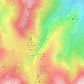
Name: La Plataforma de Gredos topographic map, elevation, terrain.
Average elevation: 6,132 ft
Minimum elevation: 5,141 ft
Maximum elevation: 6,959 ft
Other topographic maps
Click on a map to view its topography, its elevation and its terrain.
La Herguijuela
España > Castilla y León > San Juan de Gredos
La Herguijuela, San Juan de Gredos, Ávila, Castilla y León, España
Average elevation: 5,417 ft