
L Etoile topographic map
Interactive map
Click on the map to display elevation.
About this map
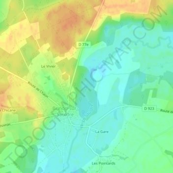
Name: L Etoile topographic map, elevation, terrain.
Average elevation: 469 ft
Minimum elevation: 417 ft
Maximum elevation: 531 ft
Other topographic maps
Click on a map to view its topography, its elevation and its terrain.
Le Château
France > Centre-Val de Loire > Brinon-sur-Sauldre
Le Château, Brinon-sur-Sauldre, Vierzon, Cher, Centre-Val de Loire, France métropolitaine, 18410, France
Average elevation: 466 ft