
Villa Kanangga topographic map
Interactive map
Click on the map to display elevation.
About this map
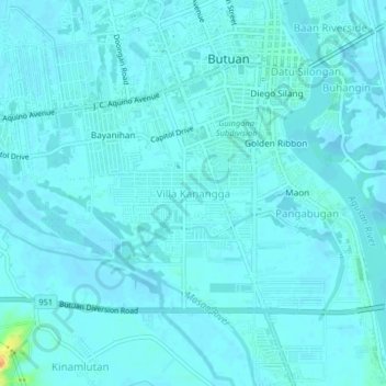
Name: Villa Kanangga topographic map, elevation, terrain.
Location: Villa Kanangga, Butuan, Caraga, 8600, Philippines (8.91438 125.51324 8.95438 125.55324)
Average elevation: 20 ft
Minimum elevation: 7 ft
Maximum elevation: 121 ft
Other topographic maps
Click on a map to view its topography, its elevation and its terrain.