
El Espartal topographic map
Interactive map
Click on the map to display elevation.
About this map
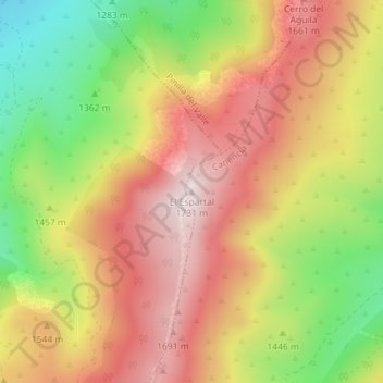
Name: El Espartal topographic map, elevation, terrain.
Location: El Espartal, Canencia, Comunidad de Madrid, 28749, España (40.88770 -3.80893 40.88780 -3.80883)
Average elevation: 4,879 ft
Minimum elevation: 3,901 ft
Maximum elevation: 5,679 ft
Other topographic maps
Click on a map to view its topography, its elevation and its terrain.
Las Matas
España > Comunidad de Madrid > Canencia
Las Matas, Canencia, Sierra Norte, Comunidad de Madrid, España
Average elevation: 3,894 ft
Acebo del puerto de Canencia. Árbol singular de la Comunidad de Madrid Nº 76
España > Comunidad de Madrid > Canencia
Acebo del puerto de Canencia. Árbol singular de la Comunidad de Madrid Nº 76, Puente de la Pasada, Canencia, Sierra Norte, Comunidad de Madrid, España
Average elevation: 4,869 ft