
Belsele topographic map
Interactive map
Click on the map to display elevation.
About this map
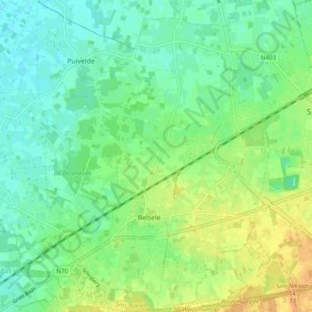
Name: Belsele topographic map, elevation, terrain.
Location: Belsele, Sint-Niklaas, Oost-Vlaanderen, Vlaanderen, 9111, België (51.12996 4.05861 51.18395 4.12397)
Average elevation: 43 ft
Minimum elevation: 3 ft
Maximum elevation: 105 ft
Other topographic maps
Click on a map to view its topography, its elevation and its terrain.
Heimolen
België > Oost-Vlaanderen > Sint-Niklaas > Sint-Niklaas
Heimolen, Sint-Niklaas, Oost-Vlaanderen, Vlaanderen, 9100, België
Average elevation: 79 ft
Afwatering van Zwaanaarde
België > Oost-Vlaanderen > Sint-Niklaas > Sint-Niklaas > Sinaai > Zwaanaarde
Afwatering van Zwaanaarde, Zwaanaarde, Sinaai, Sint-Niklaas, Oost-Vlaanderen, Vlaanderen, 9112, België
Average elevation: 13 ft