
Els Hostalets topographic map
Interactive map
Click on the map to display elevation.
About this map
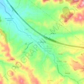
Name: Els Hostalets topographic map, elevation, terrain.
Location: Els Hostalets, Segarra, Lérida, Cataluña, España (41.61264 1.31789 41.65264 1.35789)
Average elevation: 1,923 ft
Minimum elevation: 1,654 ft
Maximum elevation: 2,290 ft