
Maton topographic map
Interactive map
Click on the map to display elevation.
About this map
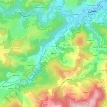
Name: Maton topographic map, elevation, terrain.
Average elevation: 1,706 ft
Minimum elevation: 1,194 ft
Maximum elevation: 2,533 ft
Other topographic maps
Click on a map to view its topography, its elevation and its terrain.
Le Monde
France > Auvergne-Rhône-Alpes > Ardèche > Lamastre
Le Monde, Lamastre, Tournon-sur-Rhône, Ardèche, Auvergne-Rhône-Alpes, France métropolitaine, 07270, France
Average elevation: 1,640 ft