
Millet Mahallesi topographic map
Interactive map
Click on the map to display elevation.
About this map
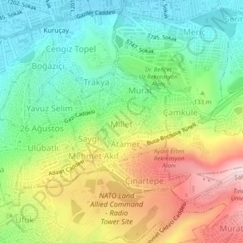
Name: Millet Mahallesi topographic map, elevation, terrain.
Location: Millet Mahallesi, Izmir, Konak, Aegean Region, Turkey (38.41142 27.17667 38.41636 27.18419)
Average elevation: 433 ft
Minimum elevation: 7 ft
Maximum elevation: 1,089 ft
Other topographic maps
Click on a map to view its topography, its elevation and its terrain.
Kadifekale
Kadifekale, Rakım Erkutlu Caddesi, Kadifekale Mahallesi, Izmir, Konak, Izmir, Aegean Region, Turkey
Average elevation: 213 ft