
Dernekpazarı topographic map
Interactive map
Click on the map to display elevation.
About this map
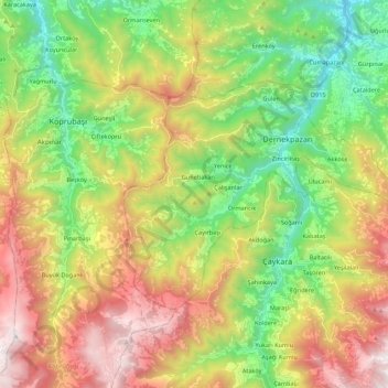
Name: Dernekpazarı topographic map, elevation, terrain.
Location: Dernekpazarı, Trabzon, Black Sea Region, Turkey (40.72722 40.15556 40.82461 40.37380)
Average elevation: 2,959 ft
Minimum elevation: 269 ft
Maximum elevation: 6,762 ft
Other topographic maps
Click on a map to view its topography, its elevation and its terrain.