
Agrobom topographic map
Interactive map
Click on the map to display elevation.
About this map
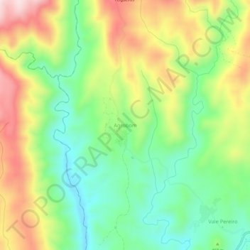
Name: Agrobom topographic map, elevation, terrain.
Location: Agrobom, Alfândega da Fé, Distrito de Bragança, Portugal (41.37816 -6.93508 41.41816 -6.89508)
Average elevation: 1,572 ft
Minimum elevation: 1,063 ft
Maximum elevation: 2,287 ft