
Чериков topographic map
Interactive map
Click on the map to display elevation.
About this map
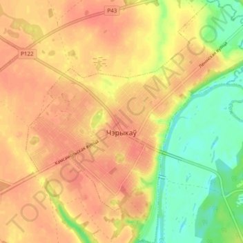
Name: Чериков topographic map, elevation, terrain.
Location: Чериков, Чериковский район, Могилёвская область, Беларусь (53.54943 31.35094 53.59393 31.42210)
Average elevation: 518 ft
Minimum elevation: 420 ft
Maximum elevation: 571 ft
Other topographic maps
Click on a map to view its topography, its elevation and its terrain.
Речица
Беларусь > Могилёвская область > Чериковский район > Речицкий сельский Совет > Речица
Речица, Речицкий сельский Совет, Чериковский район, Могилёвская область, Беларусь
Average elevation: 505 ft