
Portishead topographic map
Click on the map to display elevation.
About this map
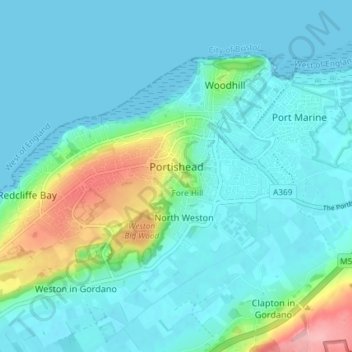
Name: Portishead topographic map, elevation, terrain.
Location: Portishead, North Somerset, England, United Kingdom (51.46364 -2.81890 51.49521 -2.74556)
Average elevation: 79 ft
Minimum elevation: 0 ft
Maximum elevation: 440 ft
Other topographic maps
Click on a map to view its topography, its elevation and its terrain.
Upper Canada
United Kingdom > England > North Somerset > Hutton > Upper Canada
Average elevation: 157 ft