
Thank you for supporting this site ❤️
Make a donation
Make a donation
Gear up for your next adventure:
As an Amazon Associate, this site earns from qualifying purchases at no extra cost to you.
上川镇 topographic map
Click on the map to display elevation.
Thank you for supporting this site ❤️
Make a donation
Make a donation
Gear up for your next adventure:
As an Amazon Associate, this site earns from qualifying purchases at no extra cost to you.
About this map
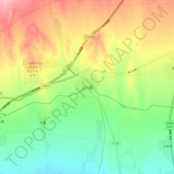
Name: 上川镇 topographic map, elevation, terrain.
Location: 上川镇, 永登县, 兰州市, 甘肃省, 中国 (36.68348 103.58478 36.76348 103.66478)
Average elevation: 7,162 ft
Minimum elevation: 6,955 ft
Maximum elevation: 7,441 ft
Thank you for supporting this site ❤️
Make a donation
Make a donation
Gear up for your next adventure:
As an Amazon Associate, this site earns from qualifying purchases at no extra cost to you.