
Thank you for supporting this site ❤️
Make a donation
Make a donation
Gear up for your next adventure:
As an Amazon Associate, this site earns from qualifying purchases at no extra cost to you.
Evaz topographic map
Click on the map to display elevation.
Thank you for supporting this site ❤️
Make a donation
Make a donation
Gear up for your next adventure:
As an Amazon Associate, this site earns from qualifying purchases at no extra cost to you.
About this map
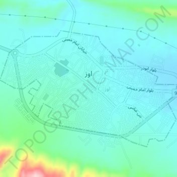
Name: Evaz topographic map, elevation, terrain.
Location: Evaz, بخش مرکزی, Evaz County, Fars Province, Iran (27.75069 53.98904 27.76939 54.02120)
Average elevation: 3,228 ft
Minimum elevation: 3,094 ft
Maximum elevation: 3,865 ft
Thank you for supporting this site ❤️
Make a donation
Make a donation
Gear up for your next adventure:
As an Amazon Associate, this site earns from qualifying purchases at no extra cost to you.