
Federal topographic map
Interactive map
Click on the map to display elevation.
About this map
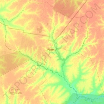
Name: Federal topographic map, elevation, terrain.
Average elevation: 217 ft
Minimum elevation: 151 ft
Maximum elevation: 253 ft
Other topographic maps
Click on a map to view its topography, its elevation and its terrain.
Las Delicias
Argentina > Entre Ríos > Distrito Francisco Ramírez > Federal > Las Delicias
Las Delicias, Federal, Distrito Francisco Ramírez, Departamento Federal, Entre Ríos, Argentina
Average elevation: 203 ft