
Bosbury topographic map
Interactive map
Click on the map to display elevation.
About this map
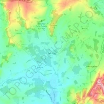
Name: Bosbury topographic map, elevation, terrain.
Location: Bosbury, Herefordshire, England, United Kingdom (52.06721 -2.49604 52.11165 -2.40640)
Average elevation: 328 ft
Minimum elevation: 180 ft
Maximum elevation: 699 ft