
Floresta do Araguaia topographic map
Interactive map
Click on the map to display elevation.
About this map
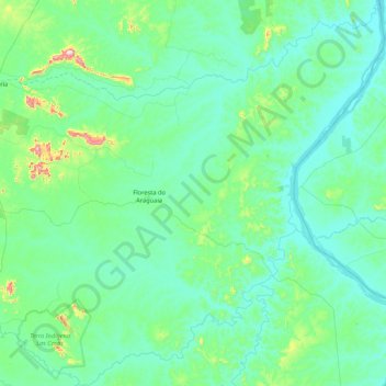
Name: Floresta do Araguaia topographic map, elevation, terrain.
Average elevation: 633 ft
Minimum elevation: 430 ft
Maximum elevation: 2,208 ft
Other topographic maps
Click on a map to view its topography, its elevation and its terrain.
Ametista
Brasil > Pará > Floresta do Araguaia > Ametista
Ametista, Floresta do Araguaia, Região Geográfica Imediata de Redenção, Região Geográfica Intermediária de Redenção, Pará, Região Norte, Brasil
Average elevation: 505 ft