
Blaasveld topographic map
Interactive map
Click on the map to display elevation.
About this map
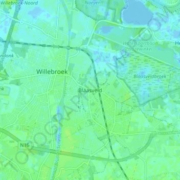
Name: Blaasveld topographic map, elevation, terrain.
Location: Blaasveld, Willebroeck, Anvers, Flandre, 2830, Belgique (51.03652 4.35235 51.07652 4.39235)
Average elevation: 13 ft
Minimum elevation: -7 ft
Maximum elevation: 26 ft