Geolocate

Madaguing topographic map

Click on the map to display elevation.

About this map

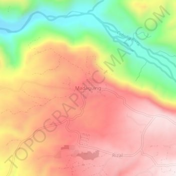
Name: Madaguing topographic map, elevation, terrain.

Location: Madaguing, Misamis Oriental, Northern Mindanao, Philippines (8.65006 124.85843 8.69006 124.89843)

Average elevation: 1,978 ft

Minimum elevation: 709 ft

Maximum elevation: 2,920 ft

Other topographic maps

Click on a map to view its topography, its elevation and its terrain.

Gingoog

Philippines > Misamis Oriental

Average elevation: 1,470 ft

Gear up for your next adventure:

🩹Survival Bandages - High‑quality bandages for emergencies
💧Water Filtration Bottles - Safely drink from streams and lakes while exploring
🧯Emergency Survival Kit - All‑in‑one survival essentials for the backcountry
🪓Survival Multi‑Tool - Versatile tool for camp and trail tasks
🧭Map Reading Tools - Tools and kits for map navigation

As an Amazon Associate, this site earns from qualifying purchases at no extra cost to you.