
Nizza Monferrato topographic map
Interactive map
Click on the map to display elevation.
About this map
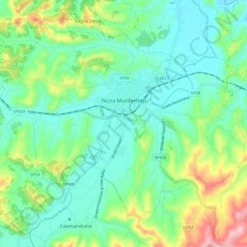
Name: Nizza Monferrato topographic map, elevation, terrain.
Location: Nizza Monferrato, Asti, Piemont, Italien (44.73854 8.30315 44.79473 8.40383)
Average elevation: 607 ft
Minimum elevation: 397 ft
Maximum elevation: 1,171 ft
Der Ort liegt auf einer Höhe von 137 m über dem Meeresspiegel am Unterlauf des Belbo (Flusssystem von Tanaro und Po), am Rande der Hügel von Asti. Das Gemeindegebiet umfasst eine Fläche von 30 km².