Geolocate

Gambier topographic map

Click on the map to display elevation.

About this map

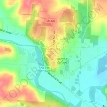
Name: Gambier topographic map, elevation, terrain.

Location: Gambier, College Township, Knox County, Ohio, United States (40.36359 -82.40407 40.38517 -82.38567)

Average elevation: 1,020 ft

Minimum elevation: 915 ft

Maximum elevation: 1,161 ft

Knox County trails, hiking, mountain biking, running and outdoor activities

Other topographic maps

Click on a map to view its topography, its elevation and its terrain.

Zuck

United States > Ohio > Knox County

Average elevation: 968 ft

Howard

United States > Ohio > Knox County

Average elevation: 978 ft

Howard

United States > Ohio > Knox County

Average elevation: 978 ft

Gear up for your next adventure:

🦟Ultrasonic Repellers - Create a bug-free zone at your camp or rest stop
Camping Coffee Makers - Enjoy premium coffee at the summit or campsite
🔭Compact Binoculars - HD vision for scouting terrain and identifying distant landmarks
🥤Water Filter Bottle - All‑in‑one filter bottle for safe hydration
🧭GPS Watch Accessories - Bands and chargers for GPS watches

As an Amazon Associate, this site earns from qualifying purchases at no extra cost to you.