
Thank you for supporting this site ❤️
Make a donation
Make a donation
Gear up for your next adventure:
As an Amazon Associate, this site earns from qualifying purchases at no extra cost to you.
Paracho de Verduzco topographic map
Click on the map to display elevation.
Thank you for supporting this site ❤️
Make a donation
Make a donation
Gear up for your next adventure:
As an Amazon Associate, this site earns from qualifying purchases at no extra cost to you.
About this map
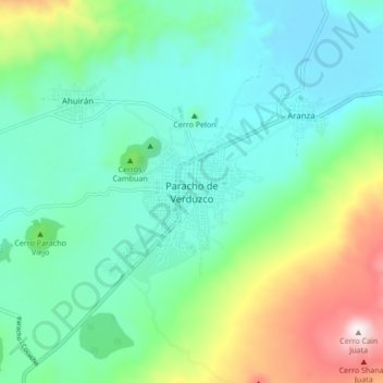
Name: Paracho de Verduzco topographic map, elevation, terrain.
Location: Paracho de Verduzco, Paracho, Michoacán, 61250, Mexico (19.60659 -102.08809 19.68659 -102.00809)
Average elevation: 7,769 ft
Minimum elevation: 7,054 ft
Maximum elevation: 9,862 ft
Thank you for supporting this site ❤️
Make a donation
Make a donation
Gear up for your next adventure:
As an Amazon Associate, this site earns from qualifying purchases at no extra cost to you.