
Laguna Querococha topographic map
Interactive map
Click on the map to display elevation.
About this map
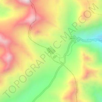
Name: Laguna Querococha topographic map, elevation, terrain.
Location: Laguna Querococha, AN-112, Llipa, Ocros, Áncash, Perú (-10.34500 -77.26520 -10.34305 -77.26269)
Average elevation: 15,610 ft
Minimum elevation: 14,465 ft
Maximum elevation: 16,558 ft
Other topographic maps
Click on a map to view its topography, its elevation and its terrain.
Laguna Querococha
Laguna Querococha, AN-112, Llipa, Ocros, Áncash, Perú
Average elevation: 15,610 ft