
C. A. Rosetti topographic map
Interactive map
Click on the map to display elevation.
About this map
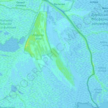
Name: C. A. Rosetti topographic map, elevation, terrain.
Location: C. A. Rosetti, Tulcea, Romania (45.20184 29.41014 45.41068 29.68917)
Average elevation: 3 ft
Minimum elevation: -13 ft
Maximum elevation: 36 ft
Other topographic maps
Click on a map to view its topography, its elevation and its terrain.
Tudor Vladimirescu
Tudor Vladimirescu, Tulcea, 820001, Romania
Average elevation: 49 ft
Danube Delta Biosphere Reserve
Danube Delta Biosphere Reserve, Tulcea, Romania
Average elevation: 0 ft