
Thank you for supporting this site ❤️
Make a donation
Make a donation
Gear up for your next adventure:
As an Amazon Associate, this site earns from qualifying purchases at no extra cost to you.
Ourthe topographic map
Click on the map to display elevation.
Thank you for supporting this site ❤️
Make a donation
Make a donation
Gear up for your next adventure:
As an Amazon Associate, this site earns from qualifying purchases at no extra cost to you.
About this map
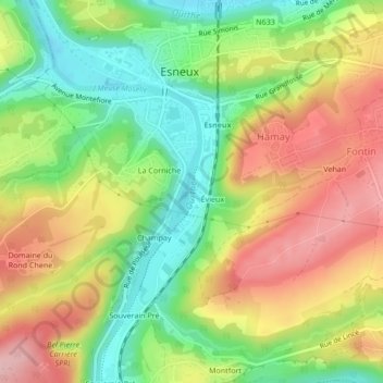
Name: Ourthe topographic map, elevation, terrain.
Location: Ourthe, Champay, Esneux, Liège, Wallonia, 4130, Belgium (50.52285 5.56774 50.52739 5.57035)
Average elevation: 505 ft
Minimum elevation: 246 ft
Maximum elevation: 791 ft
Thank you for supporting this site ❤️
Make a donation
Make a donation
Gear up for your next adventure:
As an Amazon Associate, this site earns from qualifying purchases at no extra cost to you.