Kampung Sungai Serai topographic map
Interactive map
Click on the map to display elevation.
About this map
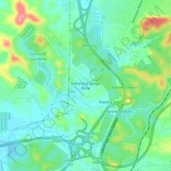
Name: Kampung Sungai Serai topographic map, elevation, terrain.
Average elevation: 177 ft
Minimum elevation: 66 ft
Maximum elevation: 459 ft

Click on the map to display elevation.
Name: Kampung Sungai Serai topographic map, elevation, terrain.
Average elevation: 177 ft
Minimum elevation: 66 ft
Maximum elevation: 459 ft