
Dayu topographic map
Interactive map
Click on the map to display elevation.
About this map
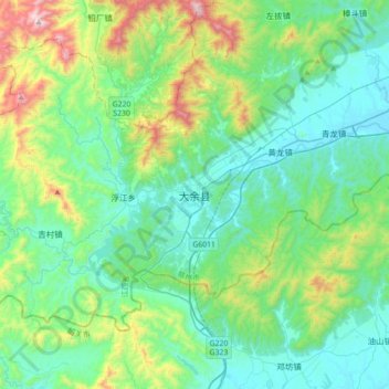
Name: Dayu topographic map, elevation, terrain.
Location: Dayu, Ganzhou, Jiangxi, China (25.24304 114.19667 25.56304 114.51667)
Average elevation: 1,293 ft
Minimum elevation: 476 ft
Maximum elevation: 4,222 ft