
Stockton-on-Tees topographic map
Interactive map
Click on the map to display elevation.
About this map
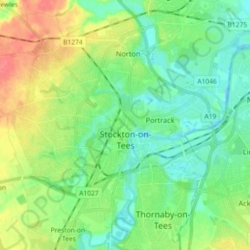
Name: Stockton-on-Tees topographic map, elevation, terrain.
Location: Stockton-on-Tees, Tees Valley, England, United Kingdom (54.53219 -1.39032 54.60460 -1.26131)
Average elevation: 62 ft
Minimum elevation: -16 ft
Maximum elevation: 180 ft
Other topographic maps
Click on a map to view its topography, its elevation and its terrain.
River Leven
United Kingdom > England > Stockton-on-Tees
River Leven, Stockton-on-Tees, Tees Valley, England, TS9 5BF, United Kingdom
Average elevation: 371 ft
Stockton-on-Tees
United Kingdom > England > Stockton-on-Tees > Stockton-on-Tees
Stockton-on-Tees, North East England, England, United Kingdom
Average elevation: 56 ft