
La Celia topographic map
Interactive map
Click on the map to display elevation.
About this map
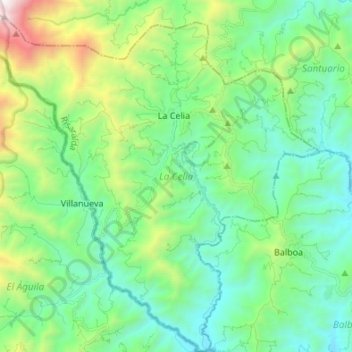
Name: La Celia topographic map, elevation, terrain.
Location: La Celia, Vertiente Occidental, Risaralda, Colombia (4.91317 -76.09631 5.04951 -75.94621)
Average elevation: 5,131 ft
Minimum elevation: 3,179 ft
Maximum elevation: 11,214 ft