

Lviv topographic map
Click on the map to display elevation.
Lviv
Lviv is on the edge of the Roztochia Upland, about 70 kilometres (43 miles) east of Polish border and 160 km (99 mi) north of the eastern Carpathian Mountains. The average altitude of Lviv is 296 metres (971 feet) above sea level. Its highest point is the Vysokyi Zamok (High Castle), 409 meters (1342 feet) above sea level. This castle has a commanding view of the historic city centre with its distinctive green-domed churches and intricate architecture.
About this map
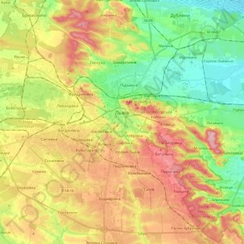
Name: Lviv topographic map, elevation, terrain.
Location: Lviv, Lviv Urban Hromada, Lviv Raion, Lviv Oblast, Ukraine (49.76817 23.89805 49.90371 24.13341)
Average elevation: 1,014 ft
Minimum elevation: 755 ft
Maximum elevation: 1,325 ft