
Riva Trigoso topographic map
Interactive map
Click on the map to display elevation.
About this map
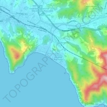
Name: Riva Trigoso topographic map, elevation, terrain.
Location: Riva Trigoso, Sestri Levante, Gênes, Ligurie, 16039, Italie (44.23925 9.40660 44.27925 9.44660)
Average elevation: 184 ft
Minimum elevation: 0 ft
Maximum elevation: 1,083 ft