
Мађаре topographic map
Interactive map
Click on the map to display elevation.
About this map
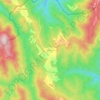
Name: Мађаре topographic map, elevation, terrain.
Location: Мађаре, Пчињски управни округ, Serbie centrale, Serbie (42.34117 21.57606 42.38117 21.61606)
Average elevation: 2,480 ft
Minimum elevation: 1,860 ft
Maximum elevation: 3,173 ft