
Herkingen topographic map
Interactive map
Click on the map to display elevation.
About this map
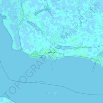
Name: Herkingen topographic map, elevation, terrain.
Location: Herkingen, Goeree-Overflakkee, Zuid-Holland, Nederland (51.68773 4.03579 51.73371 4.13242)
Average elevation: 0 ft
Minimum elevation: -7 ft
Maximum elevation: 20 ft
Other topographic maps
Click on a map to view its topography, its elevation and its terrain.
Breede Gooi
Nederland > Zuid-Holland > Goeree-Overflakkee
Breede Gooi, Goeree-Overflakkee, Zuid-Holland, Nederland, 3247XX, Nederland
Average elevation: 3 ft
Melissant
Nederland > Zuid-Holland > Goeree-Overflakkee
Melissant, Goeree-Overflakkee, Zuid-Holland, Nederland
Average elevation: 0 ft
Breede Gooi
Nederland > Zuid-Holland > Goeree-Overflakkee
Breede Gooi, Goeree-Overflakkee, Zuid-Holland, Nederland, 3247KB, Nederland
Average elevation: 3 ft