
Orea topographic map
Interactive map
Click on the map to display elevation.
About this map
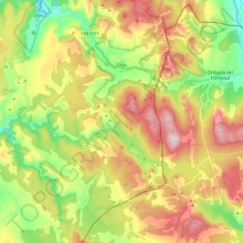
Name: Orea topographic map, elevation, terrain.
Location: Orea, Guadalajara, Castilië-La Mancha, 19311, Spanje (40.45105 -1.78451 40.59503 -1.68964)
Average elevation: 5,259 ft
Minimum elevation: 4,390 ft
Maximum elevation: 6,319 ft