
Kwaadmechelen topographic map
Interactive map
Click on the map to display elevation.
About this map
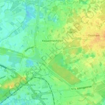
Name: Kwaadmechelen topographic map, elevation, terrain.
Location: Kwaadmechelen, Ham, Hasselt, Limburg, Vlaanderen, 3945, België (51.07370 5.09493 51.11938 5.16754)
Average elevation: 98 ft
Minimum elevation: 62 ft
Maximum elevation: 144 ft
Other topographic maps
Click on a map to view its topography, its elevation and its terrain.