
Chefchaouen topographic map
Interactive map
Click on the map to display elevation.
About this map
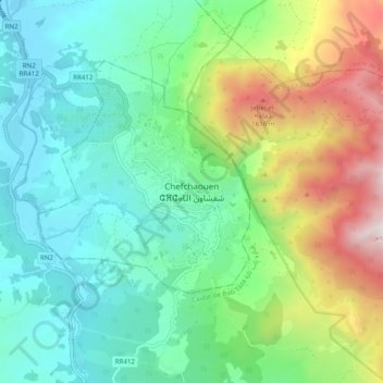
Name: Chefchaouen topographic map, elevation, terrain.
Average elevation: 2,513 ft
Minimum elevation: 876 ft
Maximum elevation: 6,509 ft
Other topographic maps
Click on a map to view its topography, its elevation and its terrain.
Chefchaouen
Chefchaouen, Province de Chefchaouen, Tanger-Tétouan-Al Hoceïma, Maroc
Average elevation: 2,031 ft