
Real de Pereira topographic map
Interactive map
Click on the map to display elevation.
About this map
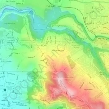
Name: Real de Pereira topographic map, elevation, terrain.
Average elevation: 3,071 ft
Minimum elevation: 2,713 ft
Maximum elevation: 3,510 ft
Other topographic maps
Click on a map to view its topography, its elevation and its terrain.
Río Virilla
Costa Rica > Provincia San José > San Rafael
Río Virilla, San Rafael, Cantón Vázquez de Coronado, Provincia San José, 11102, Costa Rica
Average elevation: 4,885 ft
San Rafael
Costa Rica > Provincia San José > San Rafael > San Rafael
San Rafael, Cantón Vázquez de Coronado, Provincia San José, 11102, Costa Rica
Average elevation: 5,016 ft