
Thank you for supporting this site ❤️
Make a donation
Make a donation
Gear up for your next adventure:
As an Amazon Associate, this site earns from qualifying purchases at no extra cost to you.
Africa topographic map
Click on the map to display elevation.
Thank you for supporting this site ❤️
Make a donation
Make a donation
Gear up for your next adventure:
As an Amazon Associate, this site earns from qualifying purchases at no extra cost to you.
About this map
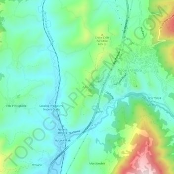
Name: Africa topographic map, elevation, terrain.
Location: Africa, Nocera Umbra, Perugia, Umbria, 06025, Italy (43.08971 12.75520 43.12971 12.79520)
Average elevation: 1,663 ft
Minimum elevation: 1,250 ft
Maximum elevation: 2,828 ft
Thank you for supporting this site ❤️
Make a donation
Make a donation
Gear up for your next adventure:
As an Amazon Associate, this site earns from qualifying purchases at no extra cost to you.