
Barrio Juan XXIII topographic map
Interactive map
Click on the map to display elevation.
About this map
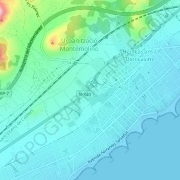
Name: Barrio Juan XXIII topographic map, elevation, terrain.
Average elevation: 121 ft
Minimum elevation: -3 ft
Maximum elevation: 778 ft
Other topographic maps
Click on a map to view its topography, its elevation and its terrain.
El Queralt
España > Comunidad Valenciana > Benicasim > Montemolino
El Queralt, Montemolino, Benicasim, Plana Alta, Castellón, Comunidad Valenciana, 12560, España
Average elevation: 351 ft