
La Malinche topographic map
Interactive map
Click on the map to display elevation.
About this map
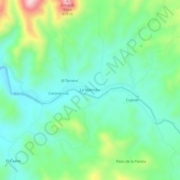
Name: La Malinche topographic map, elevation, terrain.
Location: La Malinche, Zirándaro, Guerrero, México (18.38921 -101.38646 18.42921 -101.34646)
Average elevation: 1,371 ft
Minimum elevation: 1,030 ft
Maximum elevation: 2,274 ft