
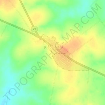
Juan Soler topographic map
Interactive map
Click on the map to display elevation.
About this map
Name: Juan Soler topographic map, elevation, terrain.
Location: Juan Soler, San José, 80007, Uruguay (-34.32880 -56.80940 -34.31938 -56.79431)
Average elevation: 243 ft
Minimum elevation: 164 ft
Maximum elevation: 315 ft
Other topographic maps
Click on a map to view its topography, its elevation and its terrain.