
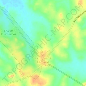
Cruz de los Caminos topographic map
Interactive map
Click on the map to display elevation.
About this map
Name: Cruz de los Caminos topographic map, elevation, terrain.
Location: Cruz de los Caminos, Tacuarembó, 45000, Uruguay (-32.23846 -54.98882 -32.21565 -54.96293)
Average elevation: 459 ft
Minimum elevation: 404 ft
Maximum elevation: 522 ft