
浩勒图高勒镇 topographic map
Interactive map
Click on the map to display elevation.
About this map
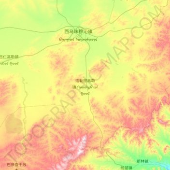
Name: 浩勒图高勒镇 topographic map, elevation, terrain.
Location: 浩勒图高勒镇, 西乌珠穆沁旗, 锡林郭勒盟, 内蒙古自治区, 中国 (44.01176 117.08602 44.64527 118.27492)
Average elevation: 3,796 ft
Minimum elevation: 2,520 ft
Maximum elevation: 6,129 ft
Other topographic maps
Click on a map to view its topography, its elevation and its terrain.