
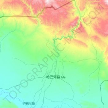
哈巴河 topographic map
Interactive map
Click on the map to display elevation.
About this map
Name: 哈巴河 topographic map, elevation, terrain.
Location: 哈巴河, 哈巴河县, 阿勒泰地区, 新疆维吾尔自治区, 中国 (47.86360 86.17625 48.53758 86.64225)
Average elevation: 2,894 ft
Minimum elevation: 1,385 ft
Maximum elevation: 8,904 ft
Other topographic maps
Click on a map to view its topography, its elevation and its terrain.