
Prairie Grove topographic map
Interactive map
Click on the map to display elevation.
About this map
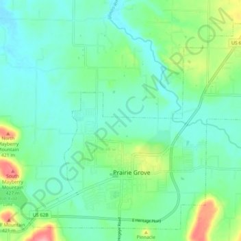
Name: Prairie Grove topographic map, elevation, terrain.
Location: Prairie Grove, Washington County, Arkansas, 72753, USA (35.96058 -94.35207 36.02494 -94.26430)
Average elevation: 1,168 ft
Minimum elevation: 1,073 ft
Maximum elevation: 1,447 ft