
A Veiga da Sarza topographic map
Interactive map
Click on the map to display elevation.
About this map
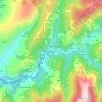
Name: A Veiga da Sarza topographic map, elevation, terrain.
Location: A Veiga da Sarza, Taramundi, Asturias, 33775, España (43.33793 -7.14459 43.37793 -7.10459)
Average elevation: 1,161 ft
Minimum elevation: 397 ft
Maximum elevation: 2,343 ft
Other topographic maps
Click on a map to view its topography, its elevation and its terrain.
Os Teixóis
España > Asturias > Taramundi > Os Teixóis
Os Teixóis, Taramundi, Asturias, 33775, España
Average elevation: 1,772 ft