
Santa Lucrécia de Algeriz e Navarra topographic map
Interactive map
Click on the map to display elevation.
About this map
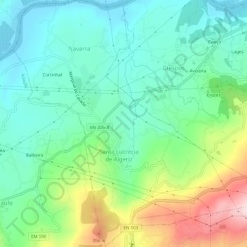
Name: Santa Lucrécia de Algeriz e Navarra topographic map, elevation, terrain.
Location: Santa Lucrécia de Algeriz e Navarra, Braga, Portugal (41.57898 -8.39280 41.61435 -8.34731)
Average elevation: 489 ft
Minimum elevation: 75 ft
Maximum elevation: 1,480 ft
Other topographic maps
Click on a map to view its topography, its elevation and its terrain.