
Casma topographic map
Interactive map
Click on the map to display elevation.
About this map
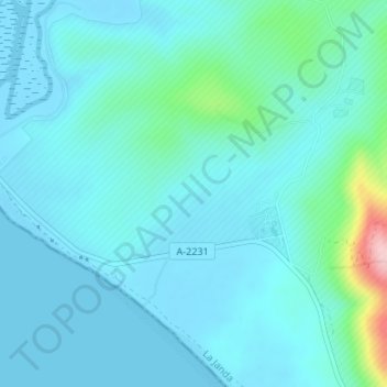
Name: Casma topographic map, elevation, terrain.
Location: Casma, Barbate, Cádiz, Andalusia, Spain (36.16057 -5.88607 36.18057 -5.86607)
Average elevation: 92 ft
Minimum elevation: -10 ft
Maximum elevation: 673 ft
Other topographic maps
Click on a map to view its topography, its elevation and its terrain.