
Achimota topographic map
Interactive map
Click on the map to display elevation.
About this map
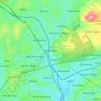
Name: Achimota topographic map, elevation, terrain.
Average elevation: 148 ft
Minimum elevation: 26 ft
Maximum elevation: 489 ft
Other topographic maps
Click on a map to view its topography, its elevation and its terrain.
Abeka
Ghana > Greater Accra Region > Okaikwei North Municipal District > Accra
Abeka, Accra, Okaikwei North Municipal District, Greater Accra Region, GA-254-4987, Ghana
Average elevation: 118 ft