
Thank you for supporting this site ❤️
Make a donation
Make a donation
Gear up for your next adventure:
As an Amazon Associate, this site earns from qualifying purchases at no extra cost to you.
Slaidburn topographic map
Click on the map to display elevation.
Thank you for supporting this site ❤️
Make a donation
Make a donation
Gear up for your next adventure:
As an Amazon Associate, this site earns from qualifying purchases at no extra cost to you.
About this map
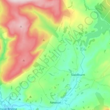
Name: Slaidburn topographic map, elevation, terrain.
Location: Slaidburn, Ribble Valley, Lancashire, England, United Kingdom (53.95181 -2.49995 54.00881 -2.37765)
Average elevation: 823 ft
Minimum elevation: 371 ft
Maximum elevation: 1,608 ft
Thank you for supporting this site ❤️
Make a donation
Make a donation
Gear up for your next adventure:
As an Amazon Associate, this site earns from qualifying purchases at no extra cost to you.